- Dallesport, Washington
- Wishram, Washington
- Biggs Junction, Oregon
- Maryhill, Washington
- Rufus, Oregon
- Arlington, Oregon
- Roosevelt, Washington
- Boardman, Oregon
- Irrigon, Oregon
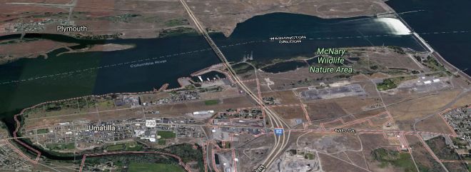
- Umatilla, Oregon
- Kennewick, Washington
- Richland, Washington
The town of Dallesport (pop. 1,202) in Klickitat County, Washington, is opposite The Dalles in Oregon. It has traditionally been the site of the Wishram tribe, who lived on the north bank of the Columbia about 10 miles in both directions from The Dalles, Oregon.
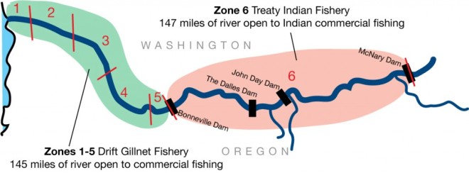
This 147-mile stretch of the river is called Zone 6 and is managed by the Columbia River Inter-Tribal Fish Commission.
All four Columbia River treaty tribes, The Nez Perce, The Umatilla, the Warm Springs, and Yakama Nation enjoy fishing rights along the Columbia from the Bonneville to McNary dams. The Columbia Gorge Airport is east of town.
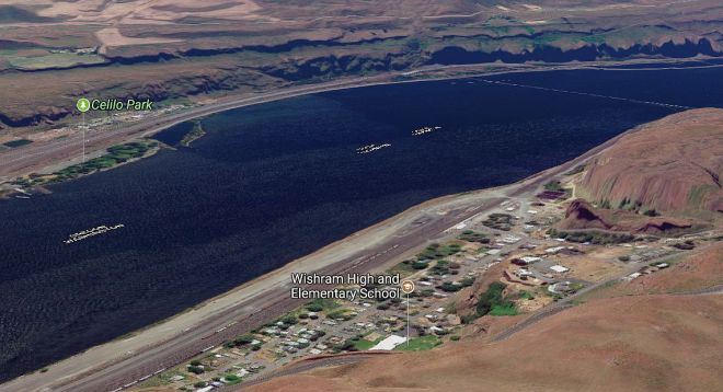
The town of Wishram (pop 213) is directly across from the historic Celilo Falls site. There have been village sites at the Wishram location for millennia… until 1957, when the falls and nearby settlements were submerged by the The Dalles Dam.
Approximately 40 petroglyph panels were removed with jackhammers before inundation and were placed in storage before being installed in Columbia Hills State Park in the 2000s.
Wishram is a hub for train traffic coming north from Oregon and California, as well as those coming west. It’s situated where bridging the Columbia River is relatively easy.
The Oregon Trunk Rail Bridge has piers resting on the exposed basalt rock above the water fall during low water periods. As a result, the SP&S Railroad was extended southward from Wishram, Washington toward Bend, Oregon.
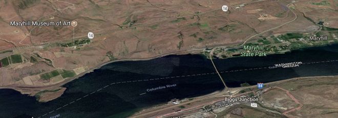
The town of Biggs Junction (pop 22) in Sherman County, Oregon is located at the junction of Interstate 84 (E/W) and U.S. 97 (N/S) where it crosses the Sam Hill Memorial Bridge over the Columbia.
Five miles downstream of Biggs Junction is the mouth of the Deschutes River. Oregon Trail pioneers crossed the John Day River, to the south, then headed west. At Biggs Junction the wagons topped a hill and saw their first views of the mighty Columbia River. The Lewis and Clark Trail also passes through the area.
Maryhill Museum of Art, Maryhill State Park, and Maryhill Stonehenge, built by Sam Hill, are on the north bank of the Columbia River, across the Columbia River from Biggs and Rufus.
The community of Maryhill is named after the wife and daughter of regional icon Sam Hill, who purchased land and envisioned a community there shortly after the turn of the 20th century.
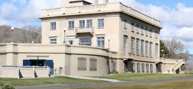
Hill’s mansion overlooking the Columbia River is now the Maryhill Museum. Sam Hill devoted much attention to advocating good roads in Washington and Oregon. Between 1909 and 1913 he built, at his own $100,000 expense, the first asphalt-paved road in the Pacific Northwest, experimenting over its 10-mile length with seven different paving techniques.
Hill constructed two notable monuments. The replica of Stonehenge, at Maryhill, commemorates the dead of World War I, while the Peace Arch, at the U.S.–Canada border, celebrates peaceful relations and the open border between the two nations.
The community of Rufus (pop 249), grew after a flood in 1894 which literally washed out the neighboring town to the west, Grant, which was never rebuilt. The city was named for an early settler, Rufus Carrol Wallis. It’s 100 miles east of Portland and 100 miles west of Pendleton.
The city of Arlington (pop 586) is in Gilliam County, the third-least populous county in Oregon. The economy got a boost from the Shepherds Flat Wind Farm, an 845 megawatt (MW) wind farm, approximately 5 miles southeast of the city. With over 300 wind turbines, it’s one of the largest wind farms in the country.
The Gorge is lined with wind farms which conveniently tie into the Bonneville transmission lines built for the dams. Other renewable energy projects include the 400 MW Golden Hills Wind Farm in Sherman County.
For nearly 30 years, a fleet of 50 garbage trucks arrives every day from Portland to windswept plateau south of Arlington, home of Waste Management’s Columbia Ridge Landfill and Recycling Center. The 12,00-acre dump employs 90 people — roughly 5 percent of the county’s population — and kicks in millions of dollars annually to local coffers. The contract is set to expire in 2019 and Portland is currently weighing whether to continue its relationship with Columbia Ridge.
The community of Roosevelt (pop. 79) is home to the Roosevelt Regional Landfill, one of the largest landfills in the United States. It converts methane gas to 20 megawatts of electricity, enough to power 20,000 homes. It has a permitted capacity of 120 million tons over 40 years, brought in by truck and rail.
Boardman (pop 3,220) in Morrow County, is 164 miles east of Portland and 25 miles west of Hermiston. The SAGE Center near the river is a popular tourist stop. Fishing, hiking, hunting, bird watching, and water sports on the Columbia River are popular pastimes. The Riverfront Center is home to the Port of Morrow and is adjacent to the River Lodge and Grill.
The city of Irrigon (pop 1,826) was named in 1903, when a newspaper editor, Addison Bennett, combined Irrigation and Oregon. The Columbia River Heritage Trail is a twelve mile recreational trail, roughly paralleling the Columbia River, connecting Irrigon and Boardman Communities. Irrigon is near the site of a former Grande Ronde Landing that vied with Umatilla Landing, 8 miles upriver for water-transportation business. The Umatilla Landing prospered, and was eventually renamed Stokes.
The Umatilla Chemical Depot which stored 12% of the nation’s stockpile of chemical weapons was destroyed by the Disposal Facility and is about 4 miles (6 km) south of the city.
The Army began weapons disposal on September 8, 2004 and completed disposal on October 25, 2011. Some 3,717 tons of Sarin, Mustard gas, and VX nerve agent were destroyed via high-temperature incineration, representing 100 percent of the base’s stockpile.
The Irrigon Hatchery is along the Columbia River about 3 miles (5 km) west of Irrigon. The Umatilla National Wildlife Refuge, between Boardman and Irrigon, was established in 1969 to help mitigate habitat lost due to the flooding following the construction of the John Day Dam.
The City of Umatilla (pop. 7,000) in the county of Umatilla, is named for the Umatilla River, which enters the Columbia River on the east side of the city and the Umatilla Tribe.
McNary Dam near the city of Umatilla, joins Oregon to Benton County, Washington. In 1968 the city moved to higher ground due to the building of the John Day Dam, completed in 1971, making it the newest dam on the lower Columbia. The Umatilla Indian Reservation lies east of Pendleton. Prehistoric settlement once thrived on the banks of the Umatilla and Columbia River. An ancient Indian burial ground remains on the land still and is protected from relic collectors and vandals.
The City of Kennewick (pop 75,000) in Benton County, may be best know for the Hanford nuclear site roughly nine miles northwest of Kennewick, which refined plutonium for the Fat Man bomb used to attack Nagasaki in 1945. The historic B Reactor, the world’s first plutonium production reactor, is now a museum. Hanford is currently the most contaminated nuclear site in the United States and is the focus of the world’s largest environmental cleanup.
Hanford also hosts a commercial nuclear power plant, as well as the Pacific Northwest National Laboratory and the LIGO Hanford Observatory which provided proof of gravity waves.
Kennewick is one of the TriCities that include Kennewick, Pasco and Richland. The Snake and Yakima rivers feed into the region. The Tri-Cities boasts more than 200 wineries within a 50-mile radius, producing some of the finest wines in the world.
The City of Richland (pop 51,150) in Benton County is one of the Tri-Cities and home to the Hanford nuclear site. For centuries the Wanapum, Yakama and Walla Walla Indians harvested salmon here, entering the Yakima River. Today that village site is called Columbia Point.
The Sacagawea Heritage Trail travels along the Columbia River through the Tri-Cities. The 23-mile multipurpose blacktop loop trail on both sides of the river goes from Sacagawea State Park at the confluence of the Snake and Columbia Rivers up to the I-182 bridge at the Columbia Point Marina on the upper end. Three bridges provide a number of ride options.
The Snake River, at 1,078 miles long, is the largest tributary of the Columbia River. The Snake River Plain was created by a volcanic hotspot which now lies underneath Yellowstone. More than 11,000 years ago, prehistoric Native Americans lived along the Snake and Oregon Trail pioneers followed the Snake River. Hells Canyon, along the border of eastern Oregon, eastern Washington and western Idaho is part of the Hells Canyon National Recreation Area and is North America’s deepest river gorge at 7,993 feet.


